As the 2024 Atlantic hurricane season unfolds, meteorologists are closely monitoring a developing storm system known as Nadine. This storm, currently referred to as ‘Invest AL94,’ is showing early signs of intensification and has the potential to become a tropical storm, and possibly a hurricane. Given the recent string of storms in the region, experts are closely tracking the trajectory and strength of Nadine.
Nadine’s Current Status
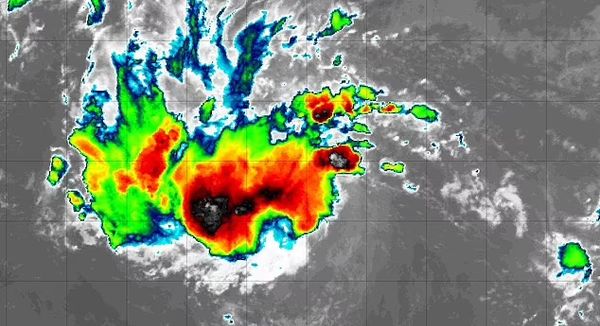
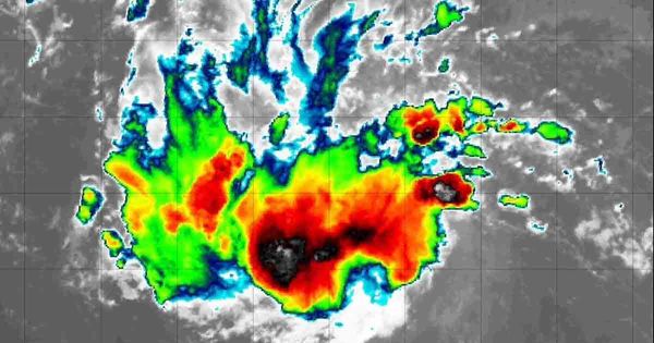
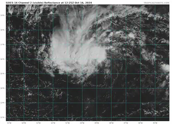
Nadine is currently located in the eastern tropical Atlantic, west of the Cabo Verde Islands. The storm system is producing winds of 28 miles per hour. Meteorologists from the National Hurricane Center (NHC) estimate a 30% chance of Nadine developing into a tropical storm within the next 48 hours, and a 40% chance over the next seven days. As this low-pressure system moves westward across warmer waters, conditions may become more favorable for its growth, potentially reaching hurricane status if winds exceed 73 miles per hour.
CBS meteorologist Joe Ruch mentioned that Nadine is “showing some signs of life” based on radar footage captured earlier this week. The NHC forecasts Nadine to move generally westward to west-northwestward. Environmental conditions are expected to allow for gradual development later in the week.
Misinformation and Social Media

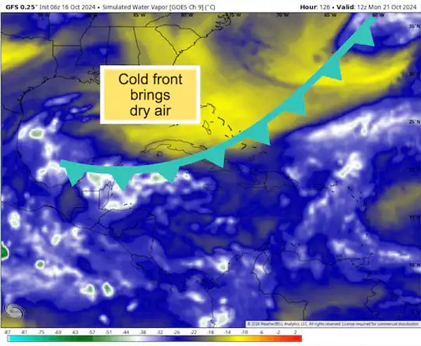
As news of Nadine’s potential spread, false claims about the storm quickly flooded social media. Some posts even suggested that Nadine would make landfall on October 18. These posts copied and pasted information and images from previous storms, such as Hurricane Helene, causing confusion. To counter this misinformation, meteorologists emphasized that while Nadine is developing, there is no confirmed threat of an immediate landfall in the United States.
The NHC has not confirmed the presence of a tropical storm or hurricane approaching U.S. shores in the coming days. However, the possibility of Nadine forming into a tropical storm remains significant. Forecasters urge people to rely on official updates and avoid falling prey to misinformation on social media.
Projected Path and Potential Impact
If Nadine continues to develop, its projected path could lead it toward the Caribbean. A “spaghetti model” of the storm’s possible trajectory indicates that it may pass north of Antigua and Barbuda, potentially moving toward the Dominican Republic, the southern tip of Cuba, and even Jamaica. While the storm is not currently forecast to head directly for Florida, meteorologists cannot rule out the possibility of a shift in its path.
AccuWeather forecasters have placed the Caribbean on high alert, warning of potential life-threatening conditions. If Nadine gains strength, the storm could bring 4 to 8 inches of rain, with extreme models predicting up to 20 inches in some areas. The heaviest rainfall is expected over the mountainous regions of Hispaniola, where the risk of mudslides is high. In addition to heavy rain, the storm could generate tropical-storm-force winds, with gusts potentially reaching 90 miles per hour.
Florida and Surrounding Areas: A Cautious Eye
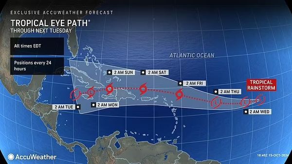
Although the current forecast does not indicate a direct threat to Florida, experts are remaining cautious. Florida could still experience onshore winds from the storm, leading to rough surf, rip currents, and coastal flooding, especially from the Florida Keys to coastal Georgia. AccuWeather’s lead hurricane forecaster, Alex DaSilva, mentioned that the storm’s future path remains uncertain, with two main possibilities: one, taking the system toward Central America and southern Mexico, and another potentially directing it toward Florida.
“The prevailing westerly breezes in the region make it unlikely for a tropical system to continue toward Texas this late in the season,” DaSilva added. However, he also noted that the situation could change.
Conclusion
As Hurricane Watchers continue to monitor Nadine’s progress, there remains a chance for the storm to strengthen into a hurricane. While the current trajectory suggests that parts of the Caribbean may be affected, the possibility of shifts in the storm’s path means that further impacts on the U.S. coast cannot be ruled out. Meteorologists urge residents in affected areas to stay vigilant and rely on official updates from the National Hurricane Center as the situation evolves.
Source:
- “Tropical Storm Watch: Hurricane Nadine still on the horizon, as Hurricane season is far from over.” Economic Times
- “Hurricane watchers say storm Nadine is ‘showing signs of life’ in new radar footage.” Daily Mail. Nikki Main. October 16, 2024.
- “Is ‘Hurricane Nadine’ going to form? NHC says there’s a chance.” WTSP. Hunter Bassler. October 14, 2024.